


Voting District 15, Lincoln County, Oklahoma
About
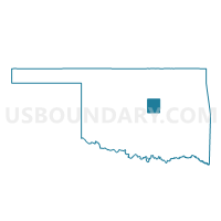
Outline

Summary
| Unique Area Identifier | 654304 |
| Name | Voting District 15 |
| County | Lincoln County |
| State | Oklahoma |
| Area (square miles) | 40.76 |
| Land Area (square miles) | 40.40 |
| Water Area (square miles) | 0.36 |
| % of Land Area | 99.12 |
| % of Water Area | 0.88 |
| Latitude of the Internal Point | 35.50258780 |
| Longtitude of the Internal Point | -97.09642990 |
Maps


Graphs
Select a template below for downloading or customizing gragh for Voting District 15, Lincoln County, Oklahoma


Neighbors
Neighoring Voting District (by Name) Neighboring Voting District on the Map
- Voting District 16, Lincoln County, OK
- Voting District 20, Lincoln County, OK
- Voting District 23, Pottawatomie County, OK
- Voting District 31, Pottawatomie County, OK
- Voting District 317, Oklahoma County, OK
- Voting District 361, Oklahoma County, OK
- Voting District 364, Oklahoma County, OK
- Voting District 592, Oklahoma County, OK
Top 10 Neighboring County Subdivision (by Population) Neighboring County Subdivision on the Map
- Oklahoma City Southeast CCD, Oklahoma County, OK (145,193)
- Shawnee CCD, Pottawatomie County, OK (64,590)
- Oklahoma City Northeast CCD, Oklahoma County, OK (16,972)
- Meeker CCD, Lincoln County, OK (7,782)
- Wellston CCD, Lincoln County, OK (4,319)
Top 10 Neighboring Place (by Population) Neighboring Place on the Map
Top 10 Neighboring Elementary School District (by Population) Neighboring Elementary School District on the Map
Top 10 Neighboring Unified School District (by Population) Neighboring Unified School District on the Map
Top 10 Neighboring State Legislative District Lower Chamber (by Population) Neighboring State Legislative District Lower Chamber on the Map
- State House District 96, OK (41,721)
- State House District 27, OK (36,934)
- State House District 32, OK (36,057)
- State House District 28, OK (35,663)
Top 10 Neighboring State Legislative District Upper Chamber (by Population) Neighboring State Legislative District Upper Chamber on the Map
Top 10 Neighboring 111th Congressional District (by Population) Neighboring 111th Congressional District on the Map
Top 10 Neighboring Census Tract (by Population) Neighboring Census Tract on the Map
- Census Tract 5010.01, Pottawatomie County, OK (8,391)
- Census Tract 9614, Lincoln County, OK (7,782)
- Census Tract 1090.03, Oklahoma County, OK (4,726)
- Census Tract 9613, Lincoln County, OK (4,319)
- Census Tract 1090.04, Oklahoma County, OK (3,473)
- Census Tract 1087.08, Oklahoma County, OK (3,263)
- Census Tract 1090.01, Oklahoma County, OK (2,076)